Joshua Samuel Brown,
Eastern Oregon Community Engagement Coordinator, 211info
Part One of Two
Oregon is big.
Multiple trips along I-5 from California to Portland have impressed on me just how much Oregon exists between a leisurely brunch in Ashland and an early supper at a PDX food truck pod. While in the lower 50% of the 50 states population-wise (# 27, with a population of 4,318,492, according to the 2022 census), where geography is concerned Oregon comes in at #9 with a respectable 98,378.5 square miles, making up 2.59% of the USA’s total landmass.
But only after moving to Pendleton and taking on the responsibilities of Outreach Coordinator for Eastern Oregon have I come to truly appreciate just how vast my home state truly is – and how much open space lies between the region’s communities.
As long as the 300-odd miles between California and the bridges of Portland may feel, the drive passes through enough towns and cities to keep travelers from feeling genuinely isolated. Coastal mountains separate I-5 from the ocean, but even along the inland highway easterly breezes carry ocean air, letting travelers know Oregon’s coastal towns, numerous and gorgeous, are only about an hour away.
Such reassuring ocean breezes are absent along the long, vast, and lightly populated swaths of territory stretching between the cities and towns of Eastern Oregon, especially south of I-84.
A recent three-day outreach drive beginning and ending in Pendleton and passing through the counties of Grant, Harney, Malheur and Baker provided an excellent opportunity to explore both the region and gain insight.
The Route
Though among Eastern Oregon’s largest cities, Pendleton’s population (just shy of 17K) is less than 3% of Portland’s. But make no mistake, Pendleton is a city, and a veritable Metropolis compared to the next city south, Pilot Rock, which lies along the base of the Blue Mountains where two tributaries of the Umatilla River meet.
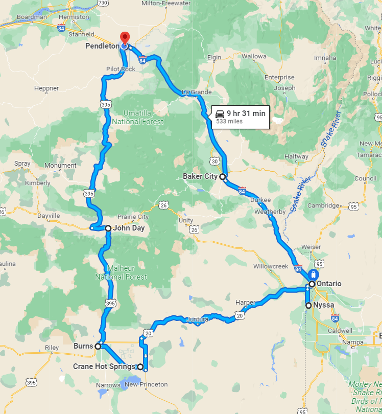
Named for a basalt rock formation which, in days gone by guided travelers along the Oregon Trail, Pilot Rock is home to 1,505 souls (at last count). Its main industries include agriculture and timber. I’d visited Pilot Rock a couple of months earlier, tabling at the annual Harvest Festival, a lively event featuring an antique car show, game booths, food trucks, and a series of town-wide yard sales.
Pilot Rock Harvest Festival, Summer 2022
The Harvest Festival was a good opportunity to get to know the town and to tell people about what 211 had to offer. But on this trip I stopped by briefly to hang a few fliers at the Shell station before hopping back in the car: Between Pilot Rock and John Day (the next town south along the road with a population above 3 digits) stretched 112 miles of two-lane road skirting the Umatilla National Forest to the east.
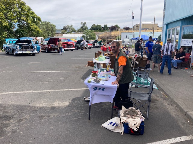
Damage from Autumn fires was present on the road to John Day
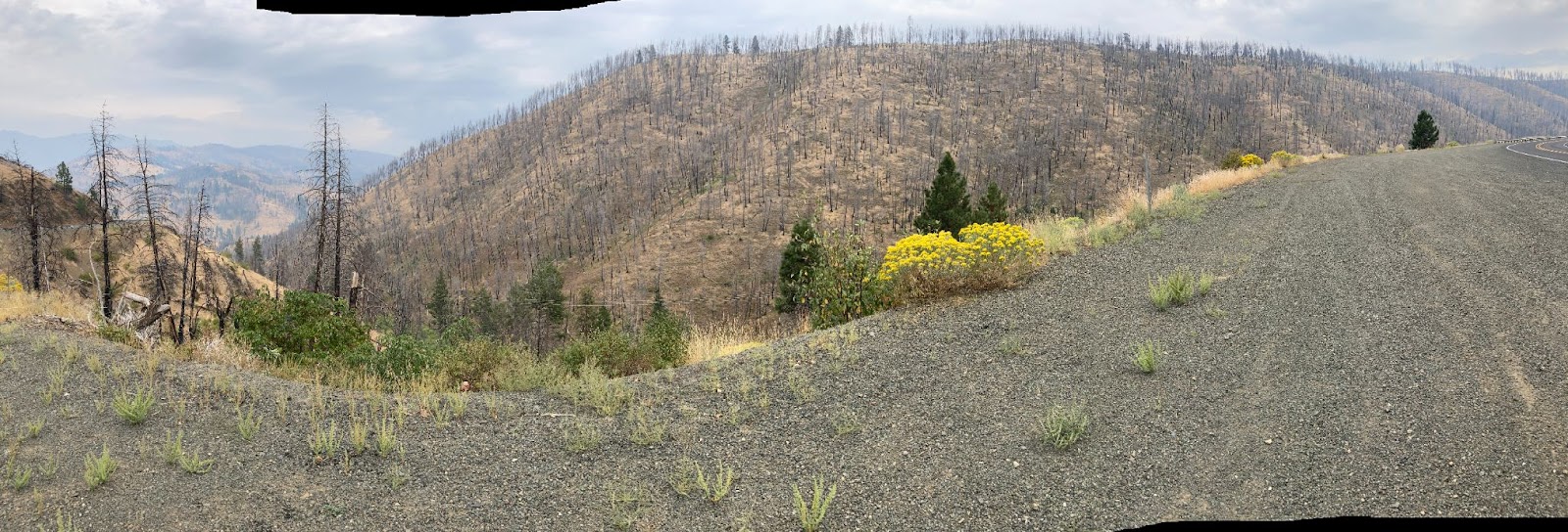
First of two 45th crossings this trip
Along the way I visited two small towns, stopping for some flier-hanging (and an excellent grilled cheese sandwich with a side of house-made tomato basil soup) in Long Creek, pausing briefly to stretch my legs and post materials in the post office and laundromat at Mt. Vernon before reaching the city of John Day.
Small in both size and population, John Day is an important administrative and social hub for the 7,000+ people who call Grant County home. I explore John Day for an hour or so, dropping off materials and introducing myself at government offices, hanging flyers along the way at laundromats, supermarkets, and libraries. Before heading out, I made a pilgrimage to a spot of personal importance to any Old China Hand living in Oregon, the Kam Wah Chung State Park, the 19th-century home of Chinese immigrant Ing “Doc” Hay. Though these days it’s a museum, in Doc Hay’s day, the place acted as a social, medical, and religious center for Oregon’s Chinese community. With a brief prayer to the good doctor’s spirit, I pinned a single Chinese language 211 childcare on the bulletin board.
Between the outskirts of John Day and Burns stretch 70 miles of winding road punctuated by a single general store with a hand-operated gas pump, where I stopped to stretch my legs and pet a dog (“he doesn’t live here, but he thinks he does,” a local man told me). I hung a couple of 211info flyers on the store’s bulletin board featuring business cards of local craftspeople, announcements of upcoming town meetings, and notices from cattle ranchers advertising stud services of prized bulls. While our flyer may not be seen by that many folks in the coming months, it’s likely to be noticed by close to 100% of the people living within 25 miles of The Bear Valley Store in Seneca, Oregon.
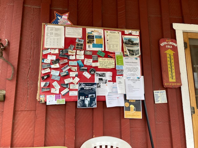
Bear Valley Store, Seneca, Oregon
According to the last census the population of Burns is 2,757, making it another city whose small size belies its importance as a commercial, social and administrative hub for people living in largely rural Harney county. Arriving close to closing time for most offices, I scoped the town out for the next day’s outreach before settling in for a quiet evening.
Hanging flyers and meeting folks in government offices the next morning confirmed that Burns was experiencing social and economic inequities similar to any found in Oregon’s larger cities. While less visible in Burns than in Portland, signs of homelessness, food insecurity, addiction, and abuse (thought by some as “strictly urban problems”) are present. But present too are numerous organizations and individuals working to assist, comfort, and otherwise be part of the solution. Chance encounters led to later discoveries, with a flier spotted in an office leading to a later phone conversation with a local pastor who’d just opened a homeless shelter and outreach station in town.
As remote as the previous day’s drive had seemed, the road south from Pendleton was practically suburban in comparison to the 113 miles of Oregon stretching between Burns and my next outreach stop, Vale, a town of about 2,000 situated 12 miles from the Idaho border. The scenery along the drive, which took the better part of 3 hours owing to road construction, varied between wide open dry plains and basalt gulches.
View from the road
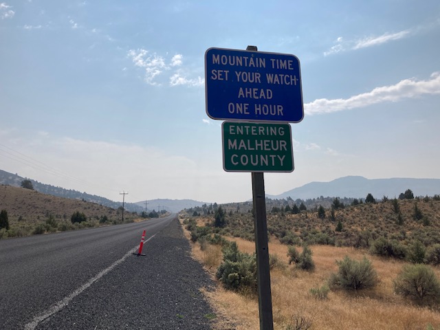
Malheur plays by its own rules
I stopped a few times along the road, once to photograph the sign announcing the Malheur time change and another just to take in the vastness of it all. Just past the Malheur border, at the only town along the road for over fifty miles, at the aptly named Oasis Cafe and Motel in Juntura.
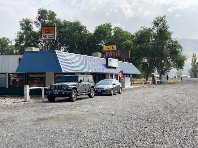
The Oasis Cafe
Spanish for Juncture, Juntura sits on the confluence of two rivers and offers the only greenery, if only briefly, for many miles in either direction. Juntura’s population is 57, and the Oasis is its sole restaurant, possibly its only business. By the entrance was a fairly empty bulletin board, so I hung the usual combination of 211info material next to the only other advertisement there, a note hung by the cafe owners themselves advertising that they were hiring a cook, with room and board included in the salary. The Oasis offers the only public toilet on the road, something the owners are keenly aware of, signs on the bathroom door gently reminding visitors that water is scarce and costly in these parts, and those stopping in even briefly ought to purchase something.
Still in the middle of nowhere and mid-way through my three-day drive, I grabbed a pickle from the jar next to the cash register for consumption on the long road ahead.
End of Part One
Part two coming soon: Bringing things full circle through Malheur and Baker Counties.